

About Us
SmallGIS is an expert in geoinformatics industry. Our team consists of highly
qualified
specialists in Satellite and Aerial Remote Sensing, Photogrammetry, Geographic
Information
System,
Information Technology Systems and GPS/GNSS Technology.
We produce specialist
GIS software.
Our
geoinformatic products are developed under the SprintMAP brand. SprintMAP software is
a family of GIS software which enables management of Polish standardised spatial data in
ArcGIS™ ESRI Inc environment and caters for other industry needs connected with management
of such data.
We also offer made-to-measure solutions
in Geographic Information Systems.
We share our practical and theoretical knowledge on a wide variety of professional GIS
trainings.
The trainings range from basic to advanced level.
SmallGIS is a guarantee of professional, reliable and individual approach to every
client. Together
with
high quality services this ensures satisfaction of everyone who decides to use our
extensive
experience
and expertise in the Photogrammetry and GIS industry.
Environmental Monitoring Aircrafts
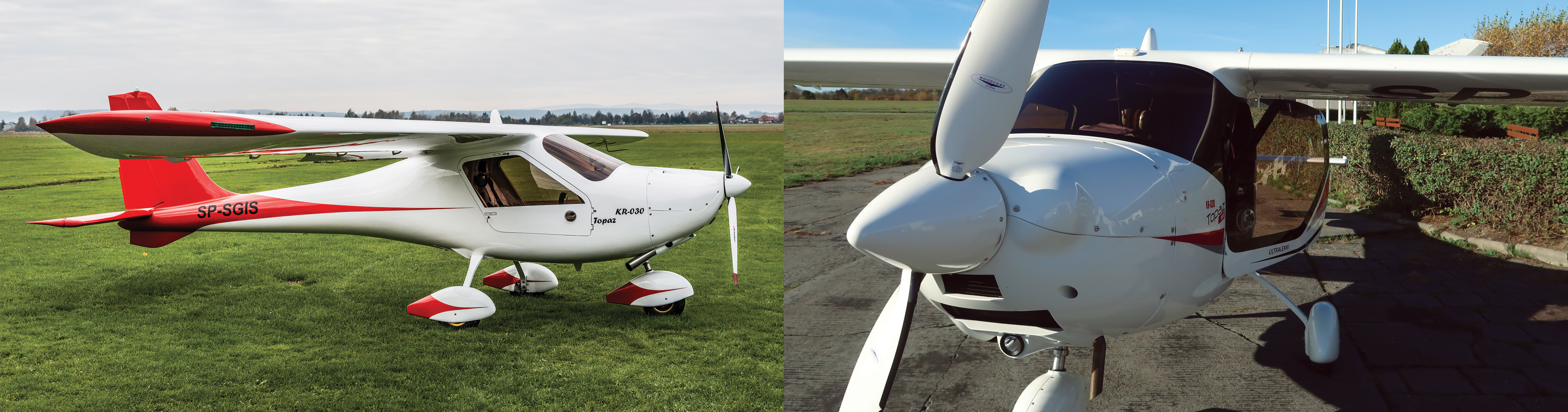
We offer integrated SkyFoton and SkyLaser manned aircraft platforms. These are comprehensive products based on specialized equipment including an aircraft with sensors, the software and the methodology that gives the possibility of independent use by the customer. The platforms can be used for very specific applications, such as counting wildlife or real-time monitoring of rescue operations, i.e. fires, floods, or for more universal and standard tasks.
Read more about out ultralight single-pilot aircraft
If you want to buy an integrated SkyFoton or SkyLaser manned aircraft platforms - contact us.
Aerial services
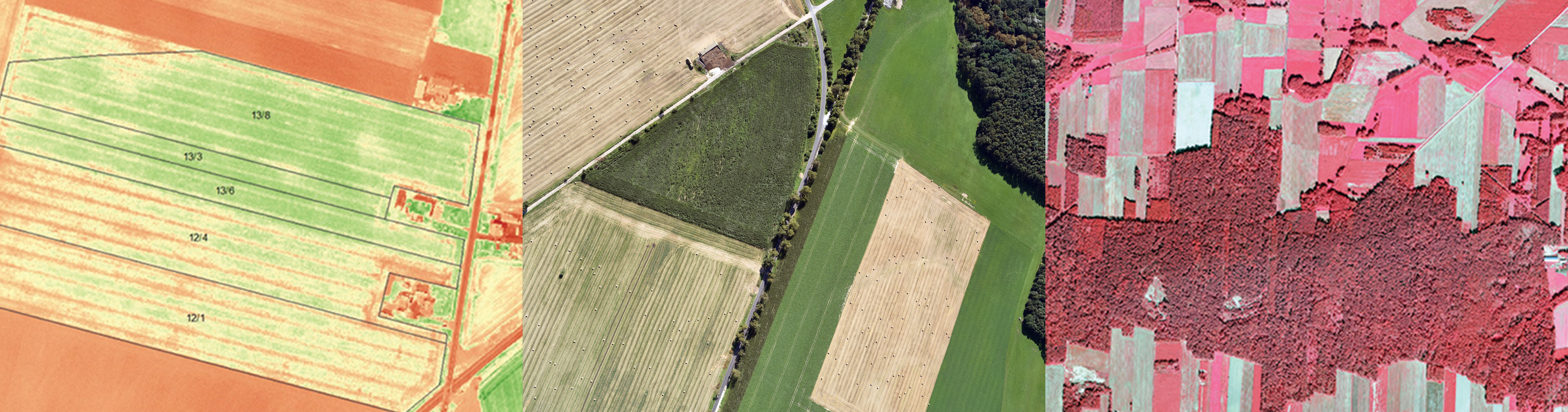
We also offer to perform:
- Small and large-area photogrammetric product studies;
- Non-standard aerial photography studies;
- Estimations, analyses, detection, inventories;
- GIS systems - which can be a remote sensing data repository and work-tool for making complex analyses.
More information about our aerial services you can find here
Portfolio
With our knowledge and many years‘ experience we are able to successfully provide various services to a wide spectrum of Clients. The list of Clients who trusted us is a guarantee of the highest level of our services. Our Clients include government administration units, state institutions, Polish and international scientific centres and private sector companies.
Here are some of our completed projects:
European Space Agency
We gain experience in international cooperation by participating in projects such as IWBSF (Integrated Web-Based Service for Forestry) and TIKKA Service (Satellite Based Tools for More Efficient Logging Operation Planning). The projects are co-funded by the European Space Agency.
Ministry of Entrepreneurship and Technology
Under the contract with the Ministry of Entrepreneurship and Technology we are implementing a project of maintaining and developing the Asbestos Database which is a tool for stocktaking products containing asbestos. The database is available to all units of local government.
Ministry of Maritime Economy and Inland Navigation
SmallGIS is implementing a project entitled: Design, construction and implementation of Maritime Administration Spatial Information System (in Polish: SIPAM) together with processing and migration of data. The system will make it possible to collect, process, view, analyse and download broadly defined spatial and descriptive data.
Ministry of Investment and Development
Under the contract with the Ministry of Investment and Development we are analysing the possibility of digitalization of investment and construction process in Poland together with developing a project of information system for issuing decisions in this process and obtaining design documentation approval.
PGL National Forests
We have cooperated with units of the National Forests for 15 years. We produce SprintMAP.LMN software which streamlines the process of day-to-day management and updating of Forest Numerical Map. We conduct numerous trainings and consultations for employees of Forest Inspectorates in spatial data management and GIS software. The offer dedicated to the National Forests also includes photogrammetry and remote sensing services i.e.: aerial photography taking and creating ortophotomaps, post-disaster and remote sensing analyses, wild animals counting.
National Parks
The cooperation with the Polish National Parks consists mainly in construction and modernization of spatial information systems in order to streamline the implementation of conservation and monitoring of natural resources plan, as well as numerous trainings conducted for parks’ employees.